3/28/10

Kaukonahua Stream (North Fork) - March 28, 2010

I did the Schofield-Waikane trail in July 2009 and found a distinct trail on the left about ten minutes from the trailhead. This junction intrigued me as to where the trail would lead to. After some internet research, I found out that the junction led to the north fork of Kaukonahua Stream. At 33 miles, Kaukonahua is the longest stream on the island of Oahu, emptying out into Kai'aka Bay in Waialua on the North Shore.

Mark and Manolo decided to join me on somewhat of an exploration hike, for I had no idea what to expect once we reached the stream. An hour of walking on the dirt road to the Schofield-Waikane trailhead was a boring jaunt, but the weather was perfect: breezy tradewinds, cloud cover, and occasional light rains. Once at the trailhead, we commenced our ten minute stroll along the Schofield-Waikane trail. Ten minutes lapsed and we finally reached the junction that would lead us down to Kaukonahua Stream.

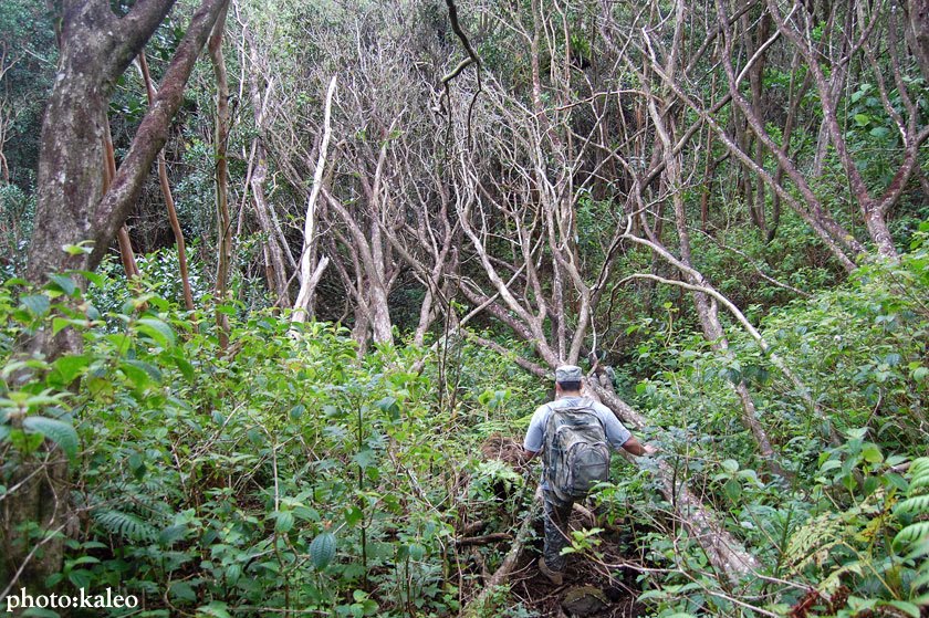
The trail descending to the stream was in very good shape. I suppose it is used often by pig hunters. The trail was a bit rough in spots, but there were lots of trees to hold on to for support. Views toward the summit and toward the Waianae Mountain Range were incredible. The vast undeveloped valleys were lush and void of anything man-made.

We finally reached the stream after about a 45 minute descent. I couldn't believe how many swimming holes there were. Every view at different points along the stream had a swimming hole, some deep enough to even jump in from higher ground. We passed a couple tunnels as we paralleled the stream to the right. The trail, still in good shape, kept going upstream, but after a good hour from the Schofield-Waikane trail, we decided to pick a spot on some boulders near a decent swimming hole.

We spent a full hour at the stream eating our lunch and recuperating for the uphill trek back to the Schofield-Waikane trail. The water was clear and cool, but we decided not to jump in. I snapped some shots with my camera and we headed back.

From start to finish, the trail took us around 6 hours to complete. It would've took us a little less time if we hadn't rested for so long at our lunch spot. I'm guessing we did about six miles total as well. Sometime in the future, I plan on exploring more upstream; the trail is in awesome shape. I wonder if I'll find a waterfall? I also wonder if the trail will hit the back walls of the Ko'olau Mountain Range. It's a beautiful lesser-known trail. Check it out if you have the time.


3/15/10

Kalauao Loop - March 14, 2010

Five months off of the trails: I'm so out of shape.

Yesterday's hike consisted of taking a wrong turn, taking the correct turn, reaching the waterfall, taking another wrong turn, taking another wrong turn, taking another wrong turn, and then taking the correct turn. It's a long story, and I won't get into the details, but damn, did we get lost in Kalauao Valley.

I hiked Kalauao Valley back in May 2008 with Shanoah and Chase. On that outing, Kalauao Stream was thigh deep, brown, and murky. When we reached Kalauao Falls, the waterfall was raging, thanks to a night of heavy rains.

This time I trekked to the waterfall with Daniel, Mark, and Justin. The stream was flowing, but not as much as it was the last time I did it, and the waterfall was a mere trickle. The water was clear, though, and a nice, shallow pool sat below the trickles of stream water.

In our 2008 hike in Kalauao Valley, Shanoah, Chase, and I tried to find a junction upstream past the waterfall. The junction would lead us back to the Aiea Loop Trail, making the trail a loop, but we didn't find it. Instead, we hiked ridiculously deep into the valley until the trail disappeared. At a certain point we just turned around and went back the way we came in.

This time around, I was anxious to find the junction, and we did find it, but we got lost three times by spotting false ribbons that led nowhere. We even contemplated on turning around. But some good judgment by Daniel and I proved worthy as we found the correct junction marked by a pink ribbon.

The trail seemed to all of a sudden manifest itself into a ridge trail. It was nothing dangerous, but it was awesome to be doing a stream hike and ridge hike all in one day. The ascent up the ridge wasn't extremely steep, but it was pretty taxing -- probably because I haven't done a hike in ages. For about fifty minutes we headed uphill, huffing and puffing, awaiting the last approach to the Aiea Loop Trail. Fifty minutes lapsed and we could hear voices in the distance, a sign that we were close to the Aiea Loop Trail.

We started at about 8:30am and ended at 12:45pm. A lot of that time was spent rambling in the wrong direction. I don't know how that happens on a stream trail, but it did. The junction upstream past the waterfall is very hard to find. I was so tired from going up ribboned pig trails and coming back down that I didn't remember how many times we crossed the stream or any noticeable landmarks that would signify the junction was near. All I can say is that it's a sharp right turn marked by a pink ribbon. I'm glad we found it, though. It's a nice, lesser known hike that branches off of one of the most popular and trodden trails on the island (Aiea Loop). Try it out. Just don't miss the critical junctions.