5/22/11

Wailele Falls - May 17th, 2011

This past Thursday before work I finally got to do a trail that had been in my sights for a quite a while. The trail was a short hike that led to Wailele Falls, a quaint waterfall located on the northeastern side of the island of Oahu. I had seen pictures of the waterfall but had no idea how to get there. The only clues I had access to was a random email I received from a guy named Alan Niwao. He told me where he started and attached a few pictures of the roads he hiked to get to the stream leading to Wailele. Although the pictures weren't much, it still led us in the right direction. A big mahalo to Alan for providing me with the info. Wailele Falls is classic.

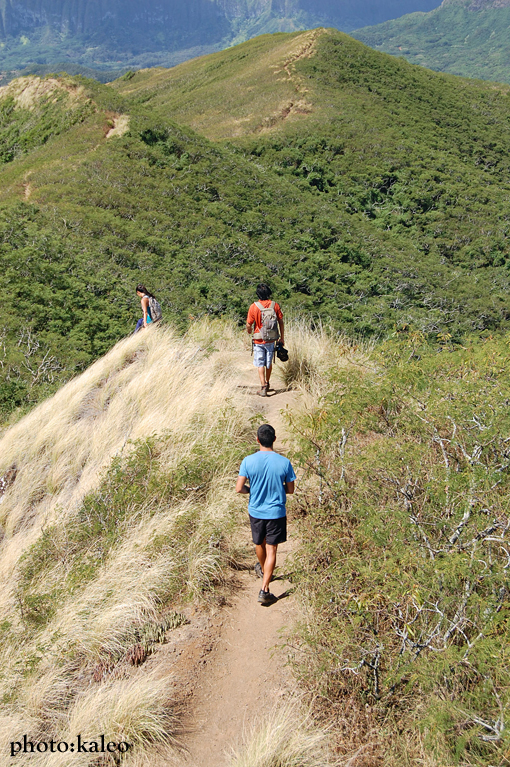
Joining me on the hike was Daniel Napoleon, Kristen Jones, Ryan Chang, Brian Bautista, and Keith Mahon. We parked at Pounders Beach Park and headed to the Koloa Gulch trailhead. I followed what I remembered in the pictures Alan sent me and soon found ourselves on private farm lands. It was a bit sketchy. At times we hiked directly on the trails through cropland, keeping an eye out for anyone who spotted us. Running through my mind was the scene from the movie "The Beach" where a group of friends run into a massive farm of weed, only to find out their presence is unwelcome. Sadly, they get shot at by the farm owners, and one or two of them die. I can't remember. Anyway, we didn't die; no one was around to shoot us when we passed through the croplands. Lucky us.

Blindly following a maze of dirt roads, we passed more farmland heading deeper into the mountains. We finally hit a well defined trail that paralleled a lively stream. A half hour of criss-crossing and rock hopping along the unmarked stream trail, and there it was: Wailele Falls. The photos I had seen on the internet does no justice. Wailele Falls is truly something to witness in person. Despite its low height, it is still an awesome sight, with a very lovely open area to just sit down, relax, and hear the rushing mountain water cascading eight feet into a large, deep mountain pool perfect for swimming. As the sun shined, the bluest color I had ever seen of a fresh water mountain pool radiated from the pool's surface, amplifying an already surreal landscape. We took a dip, snapped some photos, and headed back quickly along the stream trail to make sure we'd make it back in time for work.

The hike back was faster. We ended up following a road -- still passing farmlands -- all the way to Kamehameha Highway. I believe the dirt road we followed on our way back is the correct route; it only took us about fifty minutes to get back to our cars compared to the hour-and-a-half it took from the Koloa Gulch trailhead. Starting from the Koloa Gulch trailhead turns out be just a big mess.

Wailele Falls is definitely worth checking out again. In fact, I may be back there in several weeks to explore upstream. From what I saw, the trail keeps going deeper into the mountains. And from what I've heard, there's an even bigger waterfall about four miles in. We'll see. For now, I'm just glad I know where it is.


Following one of the roads, not knowing where it leads to.  (photo: D. Napoleon)


Passing an open field.


Finally at the stream.  (photo: B. Bautista)


Wailele Falls.  (photo: B. Bautista)


Here's Daniel standing at the top of the waterfall.  Gives a pretty good perspective of exactly how high the waterfall is.  (photo: B. Bautista)


5/16/11

Lua'alaea Falls - May 10, 2011

Lua'alaea Falls is a tall, lonely waterfall located in the back of Manoa Valley. The trail to Lua'alaea Falls branches off the extremely popular Manoa Falls trail. It is short and easy, and much more wild than the Manoa Falls trail. (Refer to the following link for trailhead directions to Manoa Falls: Manoa Falls Trailhead Directions.) Initially, the Manoa Falls trail starts off on a road. It then enters a high canopy forest and takes a left on a narrower path through lower trees. The junction to Lua'alaea Falls is located on the right after a leptospirosis warning sign. Heed a narrow crossing of Waihi Stream and follow the trail going away from the stream. The trail eventually finds its way to Lua'alea Stream and finally to Lua'alaea Falls. Go after a heavy downpour; the waterfall is more spectacular during a heavier flow.


photo: L. Yamasaki


photo: D. Napoleon


photo: L. Yamasaki


photo: L. Yamasaki


Maunawili Falls - May 5, 2011

Maunawili Falls is one of the most popular waterfall hikes on the island of Oahu. The trail winds through the lush foothills of Maunawili Valley, crossing streams and offering amazing views of the Ko'olau mountain range. At about three miles round trip, the muddy trail ends at a waterfall about thirty feet in height with a deep swimming hole that is perfect for taking a dip after working up a sweat. It is also an ideal family hike.

For directions to the trailhead, click on the following link:
Mauanawili Falls trailhead directions


photo: B. Bautista


photo: B. Bautista


5/3/11

Ka'iwa Ridge (Lanikai Pillboxes) - April 28, 2011

Over four months have passed since the year started. It's been eventful, to say the least. Looking back on the hikes I've done so far, it seems that every trail was well off the beaten path. All were either nuts, long, or both. I've come to realize that I've ignored the trails that are used quite often, where the path is wide open, the views are still awesome as ever, and you can actually exchange a smile crossing paths with other hikers along the trail. Smiles are scarce when plowing through thick vegetation, machete in hand, and backpack heavy. The familiar worry and butterflies in the stomach were non-existent this past Tuesday. It was a hike that reminded me of why I started hiking in the first place: for fun. And that's exactly what it was: not scary, not difficult, not death-defying, just fun.

There are several very popular hiking trails around the island of Oahu. Ka'iwa Ridge is one of them. It's also known as the Lanikai Pillbox trail -- "pillbox" because of the bunkers that are passed along the ridge. I never had the opportunity to hike Ka'iwa Ridge, so I wanted to give a try. Although short, the hike serves up a good workout and has nice views in all directions. It's dog-friendly and perfect for a family outing.  It's also done by the Hawaiian Trail and Mountain Club as a night hike during a full-moon.

The Ka'iwa Ridge trail follows a dry, windswept ridge above the community of Lanikai on the eastern side of Oahu. Two bunkers are passed en route to the top. From the second bunker (elev. 565 ft.), there is the option of turning back the way you came, or you can explore past the second bunker and follow an obvious trail heading inland. The trail will eventually split. First, you'll see a junction on the right that leads to a gated community bordering the Mid-Pacific Country Club.  Then a little ways past that junction is a trail coming in from the left that heads to Wailea Point. The latter option makes for a longer outing.

The views throughout the hike are awesome. Atop the bunkers looking to the ocean is the twin islets known as Na Mokulua. Moku Nui is the largest isle; Moku Iki is the smallest. To the left is Kailua Bay; beyond is Mokapu Point.  To the right is Waimanalo Bay, with Manana Island (Rabbit Island) and Makapu'u Point in the distance.  Behind, looking inland, are the tall mountain peaks of the Ko'olau mountain range.  In the forground is the three-peaked ridge known as Mount Olomana.

Directions for this trail can be found by the clicking the following link:
Na Ala Hele Ka'iwa Ridge Trail Directions


Approaching the 1st bunker.  (photo: B. Bautista)


View from the 2nd bunker looking toward Na Mokulua. (photo: B. Bautista)


photo: L. Yamasaki


Looking toward Wailea Point, Waimanalo Bay, Manana Island, and Makapu'u Point.  (photo: L. Yamasaki)


The view looking toward Kailua Bay and Mokapu Point.  (photo: L. Yamasaki)


Continuing on the trail beyond the 2nd bunker.


The towering peaks of the Ko'olau mountain range in distance.


photo: B. Bautista


In the top left portion of the photo is Mount Olomana.


Heading down.