
There are several very popular hiking trails around the island of Oahu. Ka'iwa Ridge is one of them. It's also known as the Lanikai Pillbox trail -- "pillbox" because of the bunkers that are passed along the ridge. I never had the opportunity to hike Ka'iwa Ridge, so I wanted to give a try. Although short, the hike serves up a good workout and has nice views in all directions. It's dog-friendly and perfect for a family outing. It's also done by the Hawaiian Trail and Mountain Club as a night hike during a full-moon.
The Ka'iwa Ridge trail follows a dry, windswept ridge above the community of Lanikai on the eastern side of Oahu. Two bunkers are passed en route to the top. From the second bunker (elev. 565 ft.), there is the option of turning back the way you came, or you can explore past the second bunker and follow an obvious trail heading inland. The trail will eventually split. First, you'll see a junction on the right that leads to a gated community bordering the Mid-Pacific Country Club. Then a little ways past that junction is a trail coming in from the left that heads to Wailea Point. The latter option makes for a longer outing.
The views throughout the hike are awesome. Atop the bunkers looking to the ocean is the twin islets known as Na Mokulua. Moku Nui is the largest isle; Moku Iki is the smallest. To the left is Kailua Bay; beyond is Mokapu Point. To the right is Waimanalo Bay, with Manana Island (Rabbit Island) and Makapu'u Point in the distance. Behind, looking inland, are the tall mountain peaks of the Ko'olau mountain range. In the forground is the three-peaked ridge known as Mount Olomana.
Directions for this trail can be found by the clicking the following link:
Na Ala Hele Ka'iwa Ridge Trail Directions

Approaching the 1st bunker. (photo: B. Bautista)

View from the 2nd bunker looking toward Na Mokulua. (photo: B. Bautista)

photo: L. Yamasaki

Looking toward Wailea Point, Waimanalo Bay, Manana Island, and Makapu'u Point. (photo: L. Yamasaki)

The view looking toward Kailua Bay and Mokapu Point. (photo: L. Yamasaki)
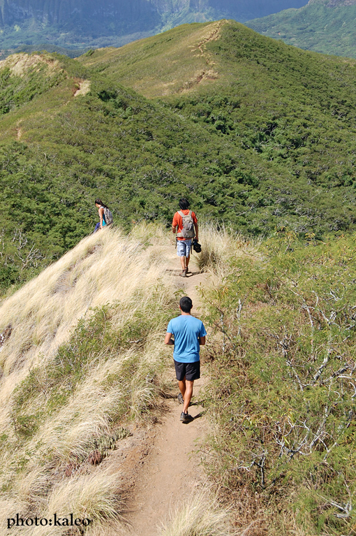
Continuing on the trail beyond the 2nd bunker.

The towering peaks of the Ko'olau mountain range in distance.

photo: B. Bautista


In the top left portion of the photo is Mount Olomana.


Heading down.


4 comments:
I with You Kaleo I'm done with defying death you can only get away with it for so long. Hiking is fun, beautiful and great exercise without the need to put ones life on the line.
I've done this trail hundreds and hundreds of times. For a while, I did it every day. It's short, has awesome views of Kailua, the Ko'olaus, Lanikai, and Waimanalo/ Bellows. The trail continues down to the end of Lanikai or to Enchanted Lakes and the Enchanted Lakes end of Blue Stone so there's room for variety. For the time invested, I can't think of a better trail on O'ahu.
im a fan... lets make a new route up diamond head
There's a third way up at the back of Lanikai. On the last street going up from the main loop, there's a house with a wide driveway, and there's a small "PICK UP YOUR DOG'S S**T" sign at the entrance to the trail. I usually go up near midpac, go down this trail, and walk back through Lanikai.
Post a Comment