A slew of empty promises was finally filled this past weekend: I hiked with the Hawaiian Trail and Mountain Club for the first time, putting to rest one hike out of three in pursuit of obtaining membership into the renown 100-year-old hiking group.
Daniel and Mark joined me for the short outing along the two-mile Ahuimanu loop trail in Kahalu'u. Around fifteen other hikers took part in the hike as well, with Joyce Oka as the trail coordinator. Joyce has been a member of the club for 40 years, and her husband, Grant Oka, a 20-year club member, was also on the hike. I was happy to have finally met Grant, for I've read many write-ups of hikes he's done in the past with other members whom inspire my passion for hiking. I found it a great opportunity to ask him questions about certain trails around the island. Although he didn't show it, I'm pretty sure he was pestered by the onslaught of questions I asked. I could have gone on and on, but he answered every question completely and as best as he could. He proved to have a wealth of knowledge of virtually every trail on the island.
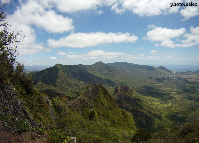
The Ahuimanu trail is a great hike for beginners; it's also great for trail running. The hike starts off along the side of Hui Kelu Street. It meanders through some forest, crosses a stream several times, ending near the base of the Ko'olau's at a large dike that spills out water. The hike is not dangerous at all, although while crossing the stream, caution should be taken because of the slippery nature of the rocks. Other than that, the trail is suited for anyone.
With one hike down, I have two more to trek with the club to obtain my club membership. After I obtain my membership, I'll be able to hike trails that require access by permit only. It'll also be a good way to meet new people, especially those that have inspired me to do the trails I've completed all around the island.
Sunday was the third time I made it to the top of Pu'u Kalena. It's one of those rare trails that tests your stamina and courage at the same time. You would think that climbing Oahu's second highest peak would take a decent amount of mileage, but it doesn't; Kalena stands around 3,500 feet, with challenging ascents, descents, and narrow ridges all clumped into six miles of trail. It is definitely the top five most dangerous treks on the island.
Marky and Kelsey joined me on Sunday's hike, and I commend them for their bravery throughout the nightmarish sections along the trail. For those who have not been on a trail like Kalena before, it takes a lot to gather yourself and walk on what seems like a ridge as thin as a gymnast's balance beam. But Marky and Kelsey took it nice and slow and made it to the top. Good job, guys!
There's not much I want to say about the hike. I've written about it before. This outing on Kalena was just really cold and windy. Plus, I took my GoPro camera and got some out of this world footage of Kalena's side ridge. I also don't have much pictures because I forgot my battery at home for my Nikon camera. But the GoPro is capable of taking still shots, so I got the chance to snap a few to post on the blog. One thing I'd like to note is that there is now a sign at the trailhead indicating that there is no hiking allowed. While climbing up, we could see a military police officer in the dirt parking lot watching us climb up the first section of the mountain. It wasn't like he was going to do anything, but I wonder if they patrol the trails to Kalena and Hapapa now. I don't know, but we didn't get caught; that's the main thing.
This will probably my last hike to Kalena for a while. For some reason, the route back is extremely taxing for me, and I despise it. And the side ridge half way through the hike is the last time I'm trekking it; it's fricken dangerous! I just did it to get footage and to make it to the green ribbon I tied to a tree the last time I did the ridge. Any other attempts to trek the ridge could seal my fate, so I'm leaving it alone. I do have my sights set on Hapapa in around two weeks, though. We'll see how the GoPro fares on that ridge.
It was discouraging to drive to the Kahekili Ridge trailhead on Sunday. Heading down the H-3, we could see rain and clouds dumping on Kailua and Kaneohe. It was not a good sign being that we were about to hike one of the most dangerous trails on the island: Pu'u Manamana. But as we passed Temple Valley, the rain stopped, the clouds cleared, and conditions looked promising as we scoped out the horizon, for there were no clouds in sight. With the breezy tradewinds, the rain and clouds would be gone before the morning's end.
Six of us (Alison, Daniel, Marky, Matt, Justin, and I) embarked on a short but adventurous loop this past weekend. I had completed the loop with my friend Chase back in September of 2008. During that outing, I had a major hangover and not much sleep the night before. My recollection of the trail was that it was ridiculously taxing. The conditions that day were not so favorable for hiking: hazy, thick vog, light winds, and no clouds whatsoever. Sunday's outing was the complete opposite. Clouds sheltered us from the sun for the majority of the hike, the constant tradewind breezes served as natural air-conditioning, and the trail itself was dry and pleasant. What we once saw as a weather catastrophe along the road, transformed into perfect conditions for hiking.
The trailhead for Kahekili Ridge starts at the end of Huamalani Road in Ka'a'awa. A good place to park is at the Swanzy Beach Park parking lot directly across from 7-Eleven, which is only about 150 yards from Huamalani Road. A good landmark to spot is a tall satellite dish tower that stands next to Ka'a'awa Fire Station. Right next to these landmarks is Huamalani Road. Follow the road to its end and there is a trail in between two houses.
The trail juts into the valley for a short time until a marked junction appears on the left. The trail gets down to business right away with the aid of ropes to achieve the crest of Kahekili Ridge. Once on the crest of Kahekili there is an abandoned bunker. The trail from here gets exceptionally narrow. As the ascent heightens, there is a very narrow section just before some massive rock formations. The drop on the left is precipitous, as is the drop on the right, but the drop on the right masks the ever-present danger with vegetation.
After this narrow section is passed, the trail contours to the right of the massive rock formations. This is where the trail gets rough, slippery, and muddy, but at a slow pace, it can be trekked safely. Eventually, the trail hits Upper Makaua Valley (aka Hidden Valley) and its stream. There was a small, trickling waterfall, a sight I had not seen the last time I did the hike. Looking makai (seaward), we stood atop a larger waterfall which by my estimates couldn't be more than about fifty feet. From our vantage point, we could see that the waterfall was multi-tiered, and I wondered if there was a trail that could access the waterfalls from the bottom of the valley. I guarantee there is a trail there. I'll have to explore it some other time.
We sat and had a few snacks at the waterfall and then crossed the stream to an indistinct trail that would eventually hit the Pu'u Manamana trail. The trail was in pretty good shape; although, I could tell that the trail gets lesser hiker traffic than usual. Some sections along the trail were choked with head-high uluhe.
After about forty minutes of battling through thick uluhe on our uphill slog, we finally reach the junction with the Manamana trail. The option here is to turn left to either reach the "Turnover" or reach the junction that leads to the Kahana Valley graveyard, or turn right and head to the narrow sections of Pu'u O Mahie Ridge. We turned right.
And there I was once again, for the fourth time along Pu'u O Mahie Ridge. Every time I encounter the ridge it still is as exhilarating as it was the last time I trekked it. It's one of the few ridges on the island where the drops on both sides will kill a person if he or she slips. For those who have heard of the trail and have never done it, it's everything you can imagine and then some.
As we descended Pu'u O Mahie Ridge, we eventually reached the junction to Crouching Lion. This option came to mind as a faster route to get back to our cars because Alison had to be at work by 4pm. There is a steep trail that descends to Makaua Village just past the Crouching Lion. I did the steep trail descent with my friend Basil back in February of 2009 while trekking the short Crouching Lion Loop Trail.
The hike took around five-and-a-half hours to complete. Ideal weather conditions and good company made this trail outing one that will be hard to forget. Below are pictures from the hike and video footage I captured with my GoPro camera. I had video footage along Kahekili Ridge's narrow sections, but the housing was fogged at that time, and the footage came out pretty shitty, so I didn't use it in the video. The footage along Mahie Ridge came out awesome! Check it out.
Manana Ridge was in our sights for this day; however, when we all met at the top of Komo Mai Drive at the top Pacific Palisades, constant rains at the trailhead swayed us to find another trail. Usually, strong tradewinds and rainy weather in the Ko'olau's means clear and ideal weather for a hike in the Waianae Mountain Range. With that in mind, I suggested we hike the Waianae Kai Loop to an unnamed peak (aptly dubbed No Name Peak), an outing I had completed back in March 2009 with my good friend Chase; however, this time I wanted to hike to Pu'u Kawiwi, a prominent peak that sits just below the terminus of Kamaileunu Ridge.
The trail from No Name Peak to Kawiwi looks very dangerous, but it also looks very doable. Upon inspection this time around, ropes would definitley be needed, for I saw a section where the ridge seemed to drop suddenly near the bottom of the saddle in between No Name Peak and Kawiwi. The drop in the ridge looked much like the "notch" on Piliwale Ridge.
Those who joined me on today's hike were Ryan, Alison, Justin, Daniel, Christian, and Ian. We shunted off up the Board of Water Supply road around 9:30am. Light rains drizzled over us until we reached the valley trail. The thick Waianae Valley canopy allowed for some shelter from the rains. We reached a section of the hike where we had to steeply climb to a view point named Three Poles. This steep section is the most cardio-demanding of the hike.
Once at Three Poles, we rested for a good fifteen minutes while munching on beef jerky and oranges. Christian even brought some maki sushi! I joked that maybe next time someone should bring a steak.
After our needed rest, we pushed along a beautiful level section toward No Name Peak. To the left were sweeping views of Waianae Valley, Lualualei Valley, Nanakuli town, Waianae town, the ocean, and neighboring peaks along the Waianae Mountain Range (Ka'ala, Kalena, Hapapa, Kaua, and Palikea); to the right was lush Makaha Valley and jagged Kea'au Ridge. Our progress along the ridge eventually reached several rock formations. These rock formations look just like Tiki's. From these Tiki Rocks, a steep trail called Tiki Ridge descends back into Waianae Valley; this trail was the trail I wanted to descend to finish the hike, for I had not done it on the last outing with Chase.
Just past the Tiki Rocks is a fenceline that keeps boars out from either side of the valleys. At times, the fenceline sits directly on top of the narrowing ridge. A rope section is in place in a steep section along the ridge, and it is here where the rock is very crumbly and caution should be used.
We all finally reached the top of No Name Peak just at an elevation of 3,000 feet. The top of No Name Peak is broad and grassy. It's broad enough to even set up camp. After a short rest, we decided to see if there was a trail descending No Name Peak to Pu'u Kawiwi. After sliding on our butts through California grass, we came to the conclusion that the trail is too dangerous to attempt without the aid of ropes, so we turned around and headed to Tiki Ridge.
Tiki Ridge is trail pioneered by Steve Rohrmayr. I contacted him by email and he told me that he actually found the ridge by accident. It is now a ridge that he and his hiking collegues hike on a regular basis. Ropes are installed on certian sections, and the trail itself is in very good condition. The ridge eventually bottoms out in Waianae Valley. After crossing the stream a few times, we finally reached the Board of Water Supply road.
I'm definitely heading back to find a trail up to Kawiwi. Steve also told me that there is a trail that leads to an ironwood grove in between Kawiwi and No Name Peak. It is from that ridge that I think I will be able to reach the terminus of Kawiwi and it's narrow ridge sections. The total time for the hike was five-and-a-half hours. It's a shame we didn't make it to Kawiwi, but there's always next time. For now, check out some of the pictures my hiking buddies shot. And check out the insane video footage I shot with my new HD Hero GoPro Camera.
*All blog entries written and photos shot by Kaleo Lancaster unless otherwise noted. Do not use photos without permission.
*The hiking trails featured on this website are dangerous regardless of its difficulty and/or your abilities and skills. Trail conditions can change in an instant. What was once there may not be there when you do it. If you attempt any of the hiking trails posted on this website, Kaleo Lancaster and Island Trails is NOT responsible for you or anyone being arrested, lost, rescued, hurt, and/or killed. Remember, it is your choice to get outside and hike.